Total Field and Gradient Magnetic Surveys
Magnetic surveys measure induced and remanent magnetization of geologic units using high-sensitivity magnetometers. These variations arise because subsurface materials respond differently to the Earth’s magnetic field based on their magnetic susceptibility.
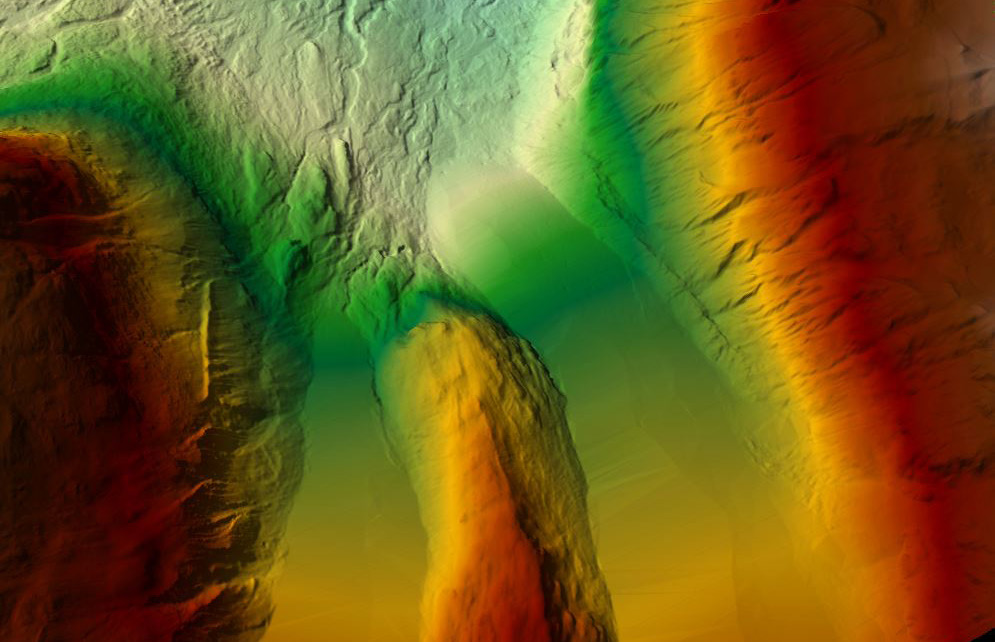
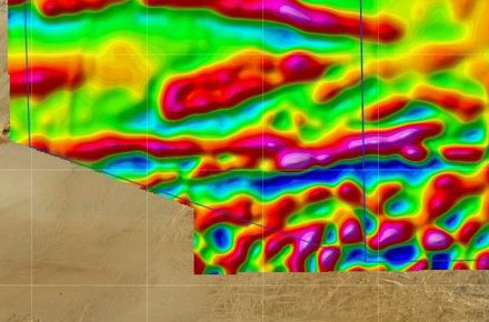
By mapping these variations, magnetic surveys help identify changes in geology, lithology, and structure, and can detect features such as ore bodies, buried metallic objects, and alteration zones. The resolution of the survey is primarily controlled by flight height and line spacing.
A total field magnetic survey uses a single sensor to measure the absolute magnetic field. From this data, several derivative products can be generated, including:
- Total Magnetic Intensity (TMI)
- Residual Magnetic Intensity (RMI)
- Analytic Signal (AS)
- First Vertical Derivative (VD1)
- Reduced to Pole (RTP)
- Tilt derivative (TDR)
- Total Horizontal Gradient (THDR)
A gradient magnetic survey uses multiple spatially separated sensors to directly measure the rate of change in the magnetic field (gradients). This enables higher-resolution detection of near-surface features and improves structural interpretation. Gradient surveys also support all standard total field-derived products.
At Axiom, all magnetic systems utilize magnetometers manufactured in Canada by GEM Systems and Scintrex, the industry standards in high-precision magnetic instrumentation. Magnetic data acquisition is also available as an add-on to our XciteTM TDEM surveys, in partnership with New Resolution Geophysics (NRG).
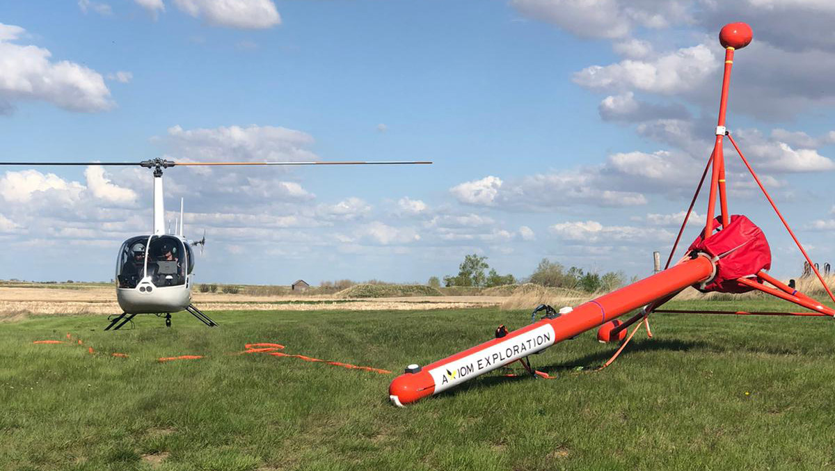
Helicopter (Magnetic Gradiometry)
Axiom’s helicopter-based triaxial gradiometer system directly measures magnetic gradients with three separate magnetometers.
This approach provides key advantages over single-sensor systems:
- Vertical gradients enhance near-surface targets and clearly define lithological and structural boundaries
- Horizontal gradients improve resolution between flight lines, reducing the need for tighter line spacing
The system is deployed approximately 100 ft below the helicopter to minimize aircraft noise and maximize data quality.
Additional payload integrations include:
Axiom Airborne Magnetic Services
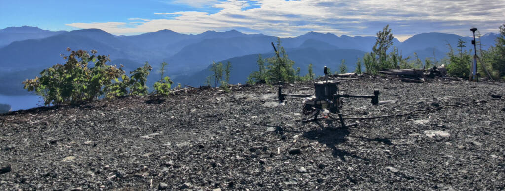
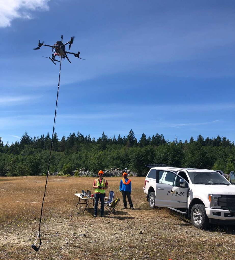
Drone Magnetics
Axiom operates two drone platforms to optimize performance across varying terrain, regulatory environments, and project scales:
- A DJI M350 RTK paired with a GSMP-35U is used for rugged or hard-to-access terrain
- An Alta X with an Airbird is designed for high-production surveys requiring higher resolution than helicopter platforms
The Alta X platform is manufactured in the United States, meeting regulatory requirements across North America.
Geophysical Consulting Services
Axiom offers end-to-end magnetic consulting services that include:
- Survey design, field training, in-field data acquisition, processing in collaboration with NRG, and inverse modelling to produce 2D and 3D forward and inversion magnetic susceptibility models.
- Third party review, remodeling, model testing, and interpretation of previously collected datasets.
- Integration of geochemical, geologic, and geophysical data with susceptibility models to improve interpretation.
Total field, reduced to pole, vertical derivative, horizontal derivative, analytic signal, and regional field removal are standard data filtering to enhance anomalies and boundaries.
Axiom can also produce 2D and 3D magnetic inversion models, if desired.
Common Applications:
- Mineral exploration
- Ore body targeting
- Structure mapping
- Landfill mapping
- Buried metallic object detection
- Biomineralization plume mapping
- Curie point depth
- Orphan or abandoned wells
- Depth to basement (bedrock)
- Pipeline detection
- Geologic mapping